
Douglass topographic map
Click on the map to display elevation.
About this map
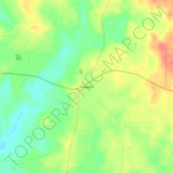
Name: Douglass topographic map, elevation, terrain.
Location: Douglass, Nacogdoches County, Texas, 75943, United States (31.64796 -94.90077 31.68796 -94.86077)
Average elevation: 341 ft
Minimum elevation: 253 ft
Maximum elevation: 436 ft
Nacogdoches County trails, hiking, mountain biking, running and outdoor activities
Other topographic maps
Click on a map to view its topography, its elevation and its terrain.