Geolocate

Serralunga topographic map

Click on the map to display elevation.

About this map

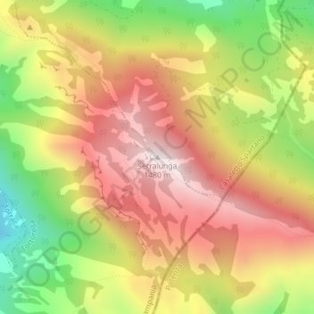
Name: Serralunga topographic map, elevation, terrain.

Location: Serralunga, Tortorella, Salerno, Campania, Italy (40.10987 15.68910 40.10997 15.68920)

Average elevation: 3,793 ft

Minimum elevation: 2,510 ft

Maximum elevation: 4,826 ft

Gear up for your next adventure:

🔦Powerful Headlamps - Ultra-bright hands-free lighting for night navigation
🔊Portable Camp Speaker - Music and alerts at camp
📦Gear Storage Bags - Organize and protect outdoor equipment
🥾Men's Hiking Boots - Durable, waterproof footwear for rugged terrain and steep inclines
📖Nature Tracking Books - Learn to track wildlife and terrain

As an Amazon Associate, this site earns from qualifying purchases at no extra cost to you.