Geolocate

Mingo topographic map

Click on the map to display elevation.

About this map

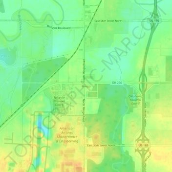
Name: Mingo topographic map, elevation, terrain.

Location: Mingo, Tulsa, Tulsa County, Oklahoma, 74117, United States (36.19980 -95.88815 36.23980 -95.84815)

Average elevation: 607 ft

Minimum elevation: 551 ft

Maximum elevation: 663 ft

Tulsa County trails, hiking, mountain biking, running and outdoor activities

Other topographic maps

Click on a map to view its topography, its elevation and its terrain.

Audobon Park

United States > Oklahoma > Tulsa County > Tulsa

Average elevation: 705 ft

Wellington South

United States > Oklahoma > Tulsa County > Tulsa

Average elevation: 676 ft

Terrace Park

United States > Oklahoma > Tulsa County > Tulsa

Average elevation: 735 ft

Gear up for your next adventure:

🎒Gear Packing Cubes - Organize your backpack efficiently
📻Weather Alert Radios - Stay informed of storm risks while off-the-grid
🥤Water Filter Bottle - All‑in‑one filter bottle for safe hydration
🧴Hand Sanitizer - Keep hands clean while hiking
🔌USB Car Charger - Car charger for on‑the‑go power needs

As an Amazon Associate, this site earns from qualifying purchases at no extra cost to you.