
Thank you for supporting this site ❤️
Make a donation
Make a donation
Gear up for your next adventure:
As an Amazon Associate, this site earns from qualifying purchases at no extra cost to you.
Oix topographic map
Click on the map to display elevation.
Thank you for supporting this site ❤️
Make a donation
Make a donation
Gear up for your next adventure:
As an Amazon Associate, this site earns from qualifying purchases at no extra cost to you.
About this map
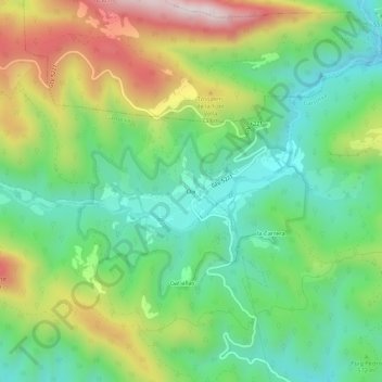
Name: Oix topographic map, elevation, terrain.
Location: Oix, Montagut i Oix, Garrotxa, Gerona, Cataluña, 17856, España (42.25201 2.50798 42.29201 2.54798)
Average elevation: 1,877 ft
Minimum elevation: 1,135 ft
Maximum elevation: 3,176 ft
Thank you for supporting this site ❤️
Make a donation
Make a donation
Gear up for your next adventure:
As an Amazon Associate, this site earns from qualifying purchases at no extra cost to you.
Other topographic maps
Click on a map to view its topography, its elevation and its terrain.
Parc Natural de Zona Volcànica de la Garrotxa
España > Cataluña > Garrotxa > Montagut i Oix
Average elevation: 1,414 ft