
Thank you for supporting this site ❤️
Make a donation
Make a donation
Gear up for your next adventure:
As an Amazon Associate, this site earns from qualifying purchases at no extra cost to you.
Gandesa topographic map
Click on the map to display elevation.
Thank you for supporting this site ❤️
Make a donation
Make a donation
Gear up for your next adventure:
As an Amazon Associate, this site earns from qualifying purchases at no extra cost to you.
About this map
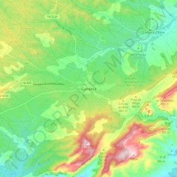
Name: Gandesa topographic map, elevation, terrain.
Location: Gandesa, Tierra Alta, Tarragona, Cataluña, 43780, España (41.01204 0.39890 41.09204 0.47890)
Average elevation: 1,276 ft
Minimum elevation: 725 ft
Maximum elevation: 2,264 ft
Thank you for supporting this site ❤️
Make a donation
Make a donation
Gear up for your next adventure:
As an Amazon Associate, this site earns from qualifying purchases at no extra cost to you.