
Thank you for supporting this site ❤️
Make a donation
Make a donation
Gear up for your next adventure:
As an Amazon Associate, this site earns from qualifying purchases at no extra cost to you.
Foraquira topographic map
Click on the map to display elevation.
Thank you for supporting this site ❤️
Make a donation
Make a donation
Gear up for your next adventure:
As an Amazon Associate, this site earns from qualifying purchases at no extra cost to you.
About this map
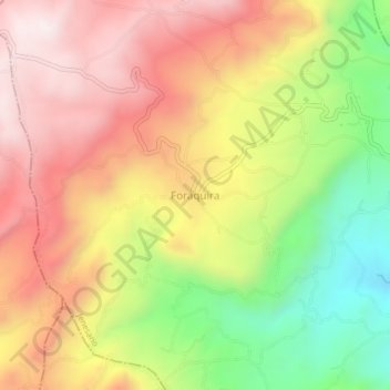
Name: Foraquira topographic map, elevation, terrain.
Location: Foraquira, Jenesano, Márquez, Boyacá, 153601, Colombia (5.36945 -73.42304 5.40945 -73.38304)
Average elevation: 8,593 ft
Minimum elevation: 7,224 ft
Maximum elevation: 9,731 ft
Thank you for supporting this site ❤️
Make a donation
Make a donation
Gear up for your next adventure:
As an Amazon Associate, this site earns from qualifying purchases at no extra cost to you.