Geolocate

Lar topographic map

Click on the map to display elevation.

About this map

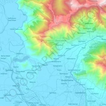
Name: Lar topographic map, elevation, terrain.

Location: Lar, Ganderbal District, Jammu and Kashmir, 191131, India (34.16772 74.64450 34.36413 74.83421)

Average elevation: 6,640 ft

Minimum elevation: 5,171 ft

Maximum elevation: 13,750 ft

Other topographic maps

Click on a map to view its topography, its elevation and its terrain.

Duderhama

India > Jammu and Kashmir > Lar

Average elevation: 5,351 ft

Gear up for your next adventure:

🧤Hiking Gloves - Protective gloves for rugged trails
🧦Merino Wool Socks - Moisture-wicking, blister-preventing socks for long treks
🪶Survival Guide Book - Expert advice for emergency preparedness
🌲Outdoor Survival Books - Best books on survival skills
🦟Ultrasonic Repellers - Create a bug-free zone at your camp or rest stop

As an Amazon Associate, this site earns from qualifying purchases at no extra cost to you.