Geolocate

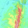
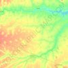
Cachoerinha topographic map

Click on the map to display elevation.

About this map

Name: Cachoerinha topographic map, elevation, terrain.

Location: Cachoerinha, Itaitu, Jacobina, Região Geográfica Imediata de Jacobina, Região Geográfica Intermediária de Feira de Santana, Bahia, Região Nordeste, Brasil (-11.36991 -40.45136 -11.32991 -40.41136)

Average elevation: 1,713 ft

Minimum elevation: 1,463 ft

Maximum elevation: 2,320 ft

Other topographic maps

Click on a map to view its topography, its elevation and its terrain.
Junco

Brasil > Bahia > Jacobina

Average elevation: 1,325 ft

Rio Itapicuru-Mirim

Brasil > Bahia > Jacobina

Average elevation: 2,034 ft

Rio Itapicuru-Mirim

Brasil > Bahia > Jacobina

Average elevation: 1,539 ft

Matriz

Brasil > Bahia > Jacobina

Average elevation: 1,772 ft

Parque Estadual das Sete Passagens

Brasil > Bahia > Jacobina

Average elevation: 1,936 ft

Gear up for your next adventure:

🌡️Portable Weather Meter - Track weather conditions on the trail
👟Trail Running Shoes - Lightweight shoes for trail runners
⌚Solar GPS Watches - Advanced multisport watches with built-in topographic maps
📡Handheld GPS Device - Reliable handheld GPS for outdoor navigation
🔌USB Car Charger - Car charger for on‑the‑go power needs

As an Amazon Associate, this site earns from qualifying purchases at no extra cost to you.