
Heath topographic map
Click on the map to display elevation.
About this map
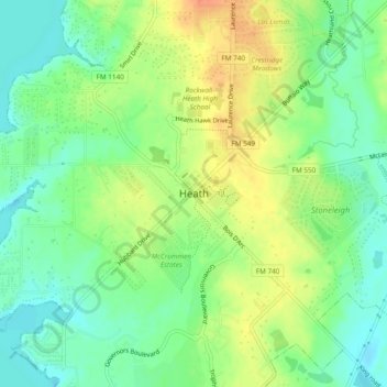
Name: Heath topographic map, elevation, terrain.
Location: Heath, Rockwall County, Texas, 75032, United States (32.81651 -96.49499 32.85651 -96.45499)
Average elevation: 486 ft
Minimum elevation: 423 ft
Maximum elevation: 568 ft