
Make a donation
Gear up for your next adventure:
As an Amazon Associate, this site earns from qualifying purchases at no extra cost to you.
Holl topographic map
Click on the map to display elevation.
Make a donation
Gear up for your next adventure:
As an Amazon Associate, this site earns from qualifying purchases at no extra cost to you.
Holl
Holl liegt im Nordosten des Stadtgebiets von Lohmar. Umliegende Ortschaften und Weiler sind Kern im Norden, Kuckenbach im Südosten, Oberstehöhe im Süden, Grünenborn im Südwesten, Neuhonrath im Westen, Hähngen und Hohnenberg im Nordwesten.
Make a donation
Gear up for your next adventure:
As an Amazon Associate, this site earns from qualifying purchases at no extra cost to you.
About this map
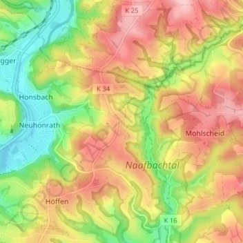
Name: Holl topographic map, elevation, terrain.
Average elevation: 541 ft
Minimum elevation: 246 ft
Maximum elevation: 817 ft
Make a donation
Gear up for your next adventure:
As an Amazon Associate, this site earns from qualifying purchases at no extra cost to you.