
Thank you for supporting this site ❤️
Make a donation
Make a donation
Gear up for your next adventure:
As an Amazon Associate, this site earns from qualifying purchases at no extra cost to you.
Anandnagar topographic map
Click on the map to display elevation.
Thank you for supporting this site ❤️
Make a donation
Make a donation
Gear up for your next adventure:
As an Amazon Associate, this site earns from qualifying purchases at no extra cost to you.
About this map
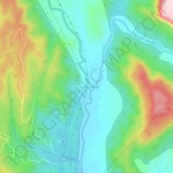
Name: Anandnagar topographic map, elevation, terrain.
Location: Anandnagar, Khalapur, Raigad, Maharashtra, India (18.69107 73.28168 18.73107 73.32168)
Average elevation: 476 ft
Minimum elevation: 125 ft
Maximum elevation: 1,276 ft
Thank you for supporting this site ❤️
Make a donation
Make a donation
Gear up for your next adventure:
As an Amazon Associate, this site earns from qualifying purchases at no extra cost to you.