Geolocate

Belona topographic map

Click on the map to display elevation.

About this map

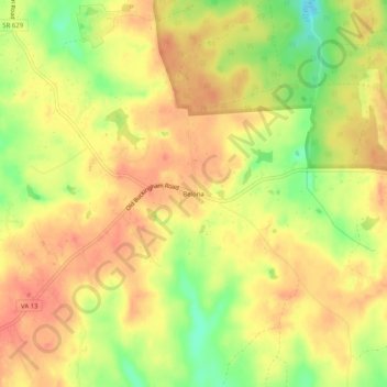
Name: Belona topographic map, elevation, terrain.

Location: Belona, Powhatan County, Virginia, United States (37.50126 -78.02861 37.54126 -77.98861)

Average elevation: 315 ft

Minimum elevation: 203 ft

Maximum elevation: 374 ft

Powhatan County trails, hiking, mountain biking, running and outdoor activities

Gear up for your next adventure:

Backpacking Tent - Lightweight and durable tent for multi‑day hikes
💧Water Filtration Bottles - Safely drink from streams and lakes while exploring
🧭Outdoor Navigation Book - Learn advanced navigation skills
📖Nature Tracking Books - Learn to track wildlife and terrain
🚪Portable Camp Chair - Foldable chair for comfort at camp

As an Amazon Associate, this site earns from qualifying purchases at no extra cost to you.