Geolocate

Imelda topographic map

Click on the map to display elevation.

About this map

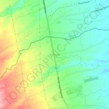
Name: Imelda topographic map, elevation, terrain.

Location: Imelda, Samal, Bataan, Central Luzon, 2113, Philippines (14.76011 120.47341 14.80011 120.51341)

Average elevation: 240 ft

Minimum elevation: 52 ft

Maximum elevation: 554 ft

Gear up for your next adventure:

Backpacking Tents - Weight-optimized shelters for multi-day topographic surveys
🪶Survival Guide Book - Expert advice for emergency preparedness
🥾Women's Hiking Boots - Top-rated trail boots with ankle support and superior grip
💧Water Purification System - Clean water on the trail with reliable purifiers
🖼️Topo Map Wall Art - Decorative topographic prints of famous peaks and regions

As an Amazon Associate, this site earns from qualifying purchases at no extra cost to you.