Geolocate

Mount Cabalian topographic map

Click on the map to display elevation.

Mount Cabalian

The stratovolcano has an elevation of 945 metres (3,100 ft) with a base diameter of 8.5 kilometres (5.3 mi). The predominant rock type is andesite. Beside solfataras, other thermal features present are hot springs located on the east and west flank of the volcano. Mainit Hot Spring in the municipality of Anahawan, Southern Leyte has a temperature of 63.4–63.9 °C (146.1–147.0 °F).

Wikipedia (CC-BY-SA 3.0)

About this map

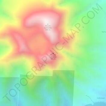
Name: Mount Cabalian topographic map, elevation, terrain.

Location: Mount Cabalian, Southern Leyte, Eastern Visayas, 6610, Philippines (10.27766 125.21915 10.27776 125.21925)

Average elevation: 1,719 ft

Minimum elevation: 620 ft

Maximum elevation: 2,989 ft

Other topographic maps

Click on a map to view its topography, its elevation and its terrain.

Macrohon

Philippines > Southern Leyte

Average elevation: 108 ft

Padre Burgos

Philippines > Southern Leyte

Average elevation: 125 ft

Gear up for your next adventure:

🎒Trail Energy Bars - High‑calorie bars for hiking energy
📱Solar Portable Charger - Solar power bank for charging devices off‑grid
💧Water Filtration Bottles - Safely drink from streams and lakes while exploring
🧦Hiking Socks - Comfortable socks to prevent blisters on long hikes
🧯Emergency Survival Kit - All‑in‑one survival essentials for the backcountry

As an Amazon Associate, this site earns from qualifying purchases at no extra cost to you.