
Thank you for supporting this site ❤️
Make a donation
Make a donation
Gear up for your next adventure:
As an Amazon Associate, this site earns from qualifying purchases at no extra cost to you.
Along topographic map
Click on the map to display elevation.
Thank you for supporting this site ❤️
Make a donation
Make a donation
Gear up for your next adventure:
As an Amazon Associate, this site earns from qualifying purchases at no extra cost to you.
About this map
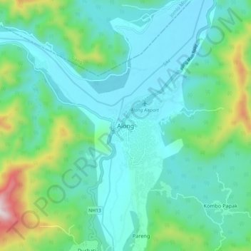
Name: Along topographic map, elevation, terrain.
Location: Along, Aalo HQ, West Siang, Arunachal Pradesh, India (28.12980 94.75854 28.20980 94.83854)
Average elevation: 1,266 ft
Minimum elevation: 702 ft
Maximum elevation: 3,504 ft
Thank you for supporting this site ❤️
Make a donation
Make a donation
Gear up for your next adventure:
As an Amazon Associate, this site earns from qualifying purchases at no extra cost to you.