Geolocate

Chalma topographic map

Click on the map to display elevation.

About this map

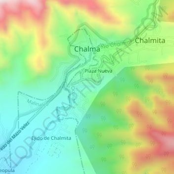
Name: Chalma topographic map, elevation, terrain.

Location: Chalma, Malinalco, State of Mexico, Mexico (18.91622 -99.44441 18.93758 -99.41381)

Average elevation: 5,764 ft

Minimum elevation: 4,964 ft

Maximum elevation: 7,152 ft

Gear up for your next adventure:

GPS Sports Watch - GPS watch for running, hiking and training
🎒Day Hiking Backpack - Lightweight backpack perfect for day trips and outdoor adventures
🧦Hiking Socks - Comfortable socks to prevent blisters on long hikes
📚USA Hiking Guide Books - Top trail guides and map books
🧥Waterproof Jacket for Hiking - Breathable and rugged rain jacket for outdoor excursions

As an Amazon Associate, this site earns from qualifying purchases at no extra cost to you.