
Thank you for supporting this site ❤️
Make a donation
Make a donation
Gear up for your next adventure:
As an Amazon Associate, this site earns from qualifying purchases at no extra cost to you.
Ottrau topographic map
Click on the map to display elevation.
Thank you for supporting this site ❤️
Make a donation
Make a donation
Gear up for your next adventure:
As an Amazon Associate, this site earns from qualifying purchases at no extra cost to you.
About this map
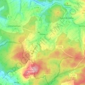
Name: Ottrau topographic map, elevation, terrain.
Location: Ottrau, Schwalm-Eder-Kreis, Hesse, 34633, Germany (50.77287 9.36346 50.82725 9.42280)
Average elevation: 1,201 ft
Minimum elevation: 942 ft
Maximum elevation: 1,542 ft
Thank you for supporting this site ❤️
Make a donation
Make a donation
Gear up for your next adventure:
As an Amazon Associate, this site earns from qualifying purchases at no extra cost to you.