

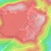
South Pittsburg topographic map
Click on the map to display elevation.
South Pittsburg
South Pittsburg is located at 35°0′30″N 85°42′38″W / 35.00833°N 85.71056°W / 35.00833; -85.71056 (35.008342, -85.710645). The city is situated in the southwestern Sequatchie Valley between the Cumberland Plateau on the west and the Tennessee River (Guntersville Lake) on the east. Two steep ridges— Whitacre Point on the north and Lodge Point on the south— extend outward from the Plateau to "wall in" the main portion of the city on the north, west, and south. The Richard City area lies opposite Lodge Point to the south, and the Battle Creek area lies opposite Whitacre Point to the north. At an elevation of approximately 630 ft (190 m), South Pittsburg is the lowest incorporated city in the East Tennessee Grand Division.
About this map
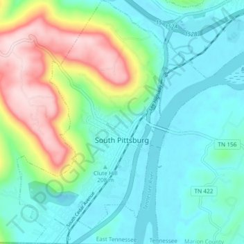
Name: South Pittsburg topographic map, elevation, terrain.
Average elevation: 892 ft
Minimum elevation: 577 ft
Maximum elevation: 1,768 ft
Marion County trails, hiking, mountain biking, running and outdoor activities
Other topographic maps
Click on a map to view its topography, its elevation and its terrain.

Big Fiery Gizzard Creek
United States > Tennessee > Marion County > Kimball
Average elevation: 1,204 ft


Raccoon Mountain Pumped Station Dam
United States > Tennessee > Marion County > Chattanooga
Average elevation: 1,362 ft