
Thank you for supporting this site ❤️
Make a donation
Make a donation
Gear up for your next adventure:
As an Amazon Associate, this site earns from qualifying purchases at no extra cost to you.
Émines topographic map
Click on the map to display elevation.
Thank you for supporting this site ❤️
Make a donation
Make a donation
Gear up for your next adventure:
As an Amazon Associate, this site earns from qualifying purchases at no extra cost to you.
About this map
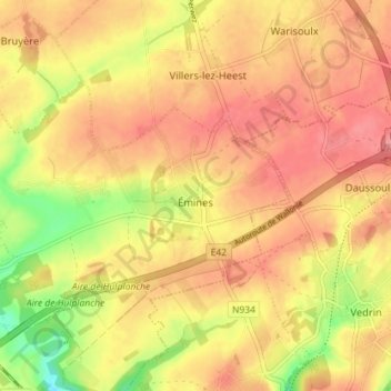
Name: Émines topographic map, elevation, terrain.
Location: Émines, La Bruyère, Namur, Wallonie, 5080, Belgique (50.49923 4.78901 50.53182 4.86029)
Average elevation: 561 ft
Minimum elevation: 400 ft
Maximum elevation: 646 ft
Thank you for supporting this site ❤️
Make a donation
Make a donation
Gear up for your next adventure:
As an Amazon Associate, this site earns from qualifying purchases at no extra cost to you.