
Thank you for supporting this site ❤️
Make a donation
Make a donation
Gear up for your next adventure:
As an Amazon Associate, this site earns from qualifying purchases at no extra cost to you.
Carretto topographic map
Click on the map to display elevation.
Thank you for supporting this site ❤️
Make a donation
Make a donation
Gear up for your next adventure:
As an Amazon Associate, this site earns from qualifying purchases at no extra cost to you.
About this map
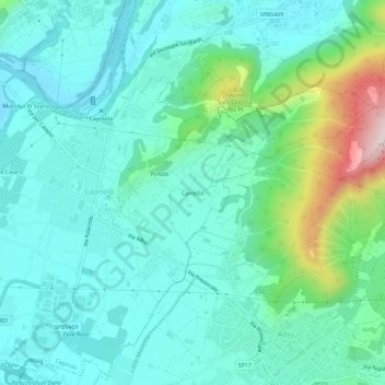
Name: Carretto topographic map, elevation, terrain.
Location: Carretto, Capriolo, Brescia, Lombardia, 24067, Italia (45.61708 9.92748 45.65708 9.96748)
Average elevation: 873 ft
Minimum elevation: 545 ft
Maximum elevation: 2,113 ft
Thank you for supporting this site ❤️
Make a donation
Make a donation
Gear up for your next adventure:
As an Amazon Associate, this site earns from qualifying purchases at no extra cost to you.