
Make a donation
Gear up for your next adventure:
As an Amazon Associate, this site earns from qualifying purchases at no extra cost to you.
Mt Magazine Falls topographic map
Click on the map to display elevation.
Make a donation
Gear up for your next adventure:
As an Amazon Associate, this site earns from qualifying purchases at no extra cost to you.
About this map
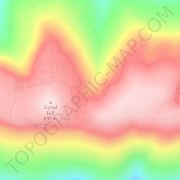
Name: Mt Magazine Falls topographic map, elevation, terrain.
Location: Mt Magazine Falls, Logan County, Arkansas, United States (35.16908 -93.63768 35.16918 -93.63758)
Average elevation: 2,251 ft
Minimum elevation: 1,421 ft
Maximum elevation: 2,753 ft
Logan County trails, hiking, mountain biking, running and outdoor activities
Make a donation
Gear up for your next adventure:
As an Amazon Associate, this site earns from qualifying purchases at no extra cost to you.
Other topographic maps
Click on a map to view its topography, its elevation and its terrain.
Mount Magazine State Park
United States > Arkansas > Logan County
There also exist many opportunities for ATV riding, backpacking, hang gliding, mountain biking, rappelling, and rock climbing within the park. The park hosts the annual Mount Magazine International Butterfly Festival, and is a haven for many rare species of butterflies in Arkansas due to the special blend of…
Average elevation: 1,467 ft
Make a donation
Gear up for your next adventure:
As an Amazon Associate, this site earns from qualifying purchases at no extra cost to you.