
Thank you for supporting this site ❤️
Make a donation
Make a donation
Gear up for your next adventure:
As an Amazon Associate, this site earns from qualifying purchases at no extra cost to you.
Yataquí topographic map
Click on the map to display elevation.
Thank you for supporting this site ❤️
Make a donation
Make a donation
Gear up for your next adventure:
As an Amazon Associate, this site earns from qualifying purchases at no extra cost to you.
About this map
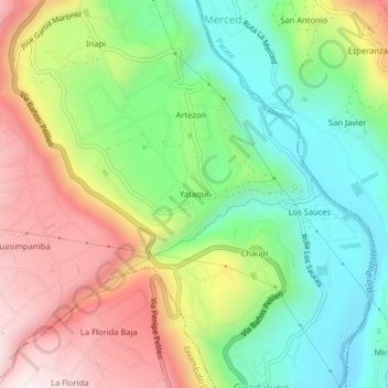
Name: Yataquí topographic map, elevation, terrain.
Location: Yataquí, Pelileo, Tungurahua, 180701, Ecuador (-1.37532 -78.52989 -1.33532 -78.48989)
Average elevation: 7,408 ft
Minimum elevation: 6,385 ft
Maximum elevation: 8,802 ft
Thank you for supporting this site ❤️
Make a donation
Make a donation
Gear up for your next adventure:
As an Amazon Associate, this site earns from qualifying purchases at no extra cost to you.