
Thank you for supporting this site ❤️
Make a donation
Make a donation
Gear up for your next adventure:
As an Amazon Associate, this site earns from qualifying purchases at no extra cost to you.
Eschwege topographic map
Click on the map to display elevation.
Thank you for supporting this site ❤️
Make a donation
Make a donation
Gear up for your next adventure:
As an Amazon Associate, this site earns from qualifying purchases at no extra cost to you.
About this map
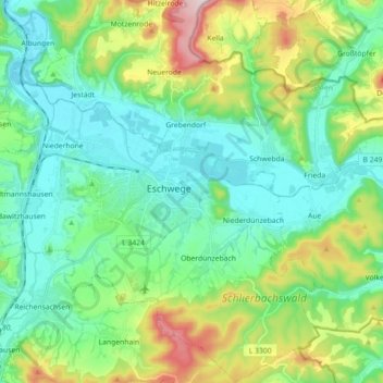
Name: Eschwege topographic map, elevation, terrain.
Location: Eschwege, Werra-Meißner-Kreis, Hesse, 37269, Germany (51.13017 9.95088 51.24140 10.12953)
Average elevation: 814 ft
Minimum elevation: 489 ft
Maximum elevation: 1,732 ft
Thank you for supporting this site ❤️
Make a donation
Make a donation
Gear up for your next adventure:
As an Amazon Associate, this site earns from qualifying purchases at no extra cost to you.