Geolocate

Dapoli topographic map

Click on the map to display elevation.

About this map

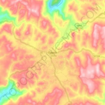
Name: Dapoli topographic map, elevation, terrain.

Location: Dapoli, Dapoli Taluka, Ratnagiri, Maharashtra, 415712, India (17.71805 73.14871 17.79805 73.22871)

Average elevation: 591 ft

Minimum elevation: 20 ft

Maximum elevation: 919 ft

Gear up for your next adventure:

🌐World Map Poster - Decorative world maps with topographic info
🎒Outdoor Daypacks - Lightweight backpacks designed for carrying maps and essential gear
🪓Survival Multi‑Tool - Versatile tool for camp and trail tasks
🎒Trail Energy Bars - High‑calorie bars for hiking energy
🏔️Mountain Trail Maps - High‑detail maps for popular peaks

As an Amazon Associate, this site earns from qualifying purchases at no extra cost to you.