
Make a donation
Gear up for your next adventure:
As an Amazon Associate, this site earns from qualifying purchases at no extra cost to you.
Hohenstein topographic map
Click on the map to display elevation.
Make a donation
Gear up for your next adventure:
As an Amazon Associate, this site earns from qualifying purchases at no extra cost to you.
About this map
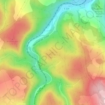
Name: Hohenstein topographic map, elevation, terrain.
Average elevation: 1,742 ft
Minimum elevation: 1,345 ft
Maximum elevation: 2,123 ft
Make a donation
Gear up for your next adventure:
As an Amazon Associate, this site earns from qualifying purchases at no extra cost to you.
Other topographic maps
Click on a map to view its topography, its elevation and its terrain.
Lengefeld
Deutschland > Sachsen > Erzgebirgskreis > Pockau-Lengefeld
Die Stadt liegt auf einem Höhenzug westlich des Flöhatals. Der niedrigste Punkt des Stadtgebietes liegt mit 373 m ü. NN im Flöhatal in der Nähe des Ortsteils Rauenstein, der höchste Punkt ist mit 686 m ü. NN der Gipfel des Adlersteins. Lengefeld liegt in der Mitte des Talsperren-Dreiecks zwischen der…
Average elevation: 1,683 ft
Make a donation
Gear up for your next adventure:
As an Amazon Associate, this site earns from qualifying purchases at no extra cost to you.
09514
Deutschland > Sachsen > Erzgebirgskreis > Pockau-Lengefeld > Lengefeld
Average elevation: 1,683 ft