Geolocate

Newtongrange topographic map

Click on the map to display elevation.

About this map

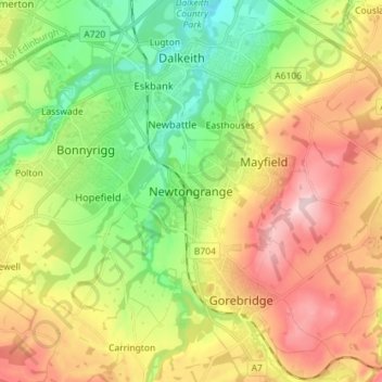
Name: Newtongrange topographic map, elevation, terrain.

Location: Newtongrange, Midlothian, Scotland, EH22 4LH, United Kingdom (55.82640 -3.10662 55.90640 -3.02662)

Average elevation: 436 ft

Minimum elevation: 85 ft

Maximum elevation: 886 ft

Gear up for your next adventure:

🔭Stargazing Telescopes - Perfect for camping in low-light pollution areas shown on maps
🧼Biodegradable Camping Soap - Eco‑friendly soap for outdoor hygiene
📚Navigation Handbooks - Master the art of reading topographic maps and using a compass
🧺Microfiber Travel Towels - Compact and fast-drying towels for trail use
🪶Survival Guide Book - Expert advice for emergency preparedness

As an Amazon Associate, this site earns from qualifying purchases at no extra cost to you.