
Thank you for supporting this site ❤️
Make a donation
Make a donation
Gear up for your next adventure:
As an Amazon Associate, this site earns from qualifying purchases at no extra cost to you.
Lavelan topographic map
Click on the map to display elevation.
Thank you for supporting this site ❤️
Make a donation
Make a donation
Gear up for your next adventure:
As an Amazon Associate, this site earns from qualifying purchases at no extra cost to you.
About this map
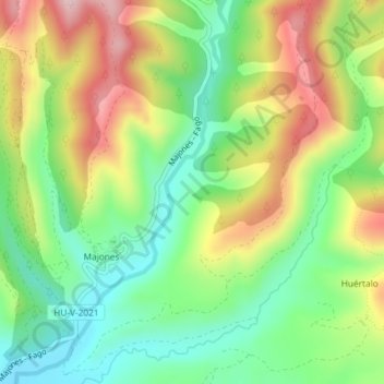
Name: Lavelan topographic map, elevation, terrain.
Location: Lavelan, Canal de Berdún, Jacétanie, Aragon, Espagne (42.65158 -0.87566 42.67158 -0.85566)
Average elevation: 2,349 ft
Minimum elevation: 1,936 ft
Maximum elevation: 2,927 ft
Thank you for supporting this site ❤️
Make a donation
Make a donation
Gear up for your next adventure:
As an Amazon Associate, this site earns from qualifying purchases at no extra cost to you.