Geolocate

Vashon topographic map

Click on the map to display elevation.

About this map

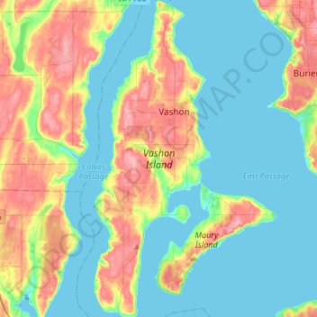
Name: Vashon topographic map, elevation, terrain.

Location: Vashon, King County, Washington, 98070, United States (47.33062 -122.52808 47.51118 -122.37371)

Average elevation: 151 ft

Minimum elevation: -13 ft

Maximum elevation: 505 ft

King County trails, hiking, mountain biking, running and outdoor activities

Gear up for your next adventure:

🗺️NatGeo Topo Maps - High-quality waterproof printed topographic maps of US Parks
🏕️Tent Footprint - Protect your tent base from wear
🥾Hiking Shoes - Durable and comfortable shoes for trail hiking
🦺Reflective Outdoor Gear - Safety gear for low‑light conditions
🥄Camping Utensil Set - Lightweight utensils for outdoor meals

As an Amazon Associate, this site earns from qualifying purchases at no extra cost to you.