Geolocate

Cherthala topographic map

Click on the map to display elevation.

About this map

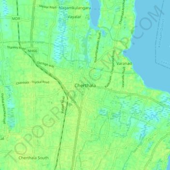
Name: Cherthala topographic map, elevation, terrain.

Location: Cherthala, Alappuzha, Kerala, 688524, India (9.64618 76.30261 9.72618 76.38261)

Average elevation: 23 ft

Minimum elevation: -7 ft

Maximum elevation: 39 ft

Other topographic maps

Click on a map to view its topography, its elevation and its terrain.

Perumkulam, Kannankara

India > Kerala > Cherthala

Average elevation: 23 ft

Gear up for your next adventure:

📦Gear Storage Bags - Organize and protect outdoor equipment
🌡️Portable Weather Meter - Track weather conditions on the trail
🩳Quick‑Dry Hiking Shorts - Comfortable and quick‑dry shorts for summer hiking
⛑️Personal Locator Beacon - Safety beacon for emergencies
🧭Compass with Lanyard - Easy‑carry compass for navigation

As an Amazon Associate, this site earns from qualifying purchases at no extra cost to you.