
Cass topographic map
Click on the map to display elevation.
About this map
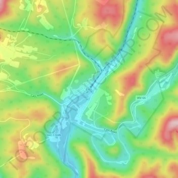
Name: Cass topographic map, elevation, terrain.
Location: Cass, Pocahontas County, West Virginia, United States (38.37679 -79.93478 38.41679 -79.89478)
Average elevation: 2,753 ft
Minimum elevation: 2,385 ft
Maximum elevation: 3,258 ft
Pocahontas County trails, hiking, mountain biking, running and outdoor activities
Other topographic maps
Click on a map to view its topography, its elevation and its terrain.
Green Bank Telescope
United States > West Virginia > Pocahontas County
As an azimuth-elevation mounting telescope, the azimuth adjustments are driven by four trucks with four wheels each on a 210-foot (64 m) diameter rail. The 16 thirty-horsepower motors can change azimuth at the rate of up to 40 degrees per minute. Azimuth axis is also supported by a pintle bearing at the center…
Average elevation: 2,697 ft