Geolocate

Newtown topographic map

Click on the map to display elevation.

About this map

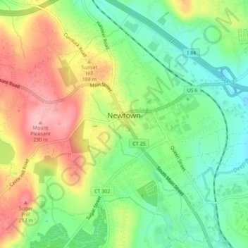
Name: Newtown topographic map, elevation, terrain.

Location: Newtown, Fairfield, Connecticut, United States of America (41.40069 -73.33331 41.42396 -73.29101)

Average elevation: 495 ft

Minimum elevation: 299 ft

Maximum elevation: 748 ft

Gear up for your next adventure:

🔪Outdoor Multitools - Essential survival tools for gear repair and field use
🔭Telescopic Hiking Pole - Adjustable pole for hiking stability
🌎3D Topographic Globes - Raised relief globes for a tactile understanding of geography
😴Insulated Sleeping Pads - Compact and warm pads for high-elevation camping
🧭Hiking Compass - Precision compass for reliable navigation in the wilderness

As an Amazon Associate, this site earns from qualifying purchases at no extra cost to you.