Geolocate

Penn Valley topographic map

Click on the map to display elevation.

About this map

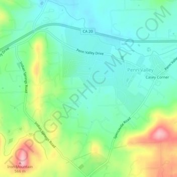
Name: Penn Valley topographic map, elevation, terrain.

Location: Penn Valley, Nevada County, California, United States (39.17932 -121.20912 39.21055 -121.17457)

Average elevation: 1,522 ft

Minimum elevation: 1,362 ft

Maximum elevation: 1,873 ft

Nevada County trails, hiking, mountain biking, running and outdoor activities

Other topographic maps

Click on a map to view its topography, its elevation and its terrain.

Penn Valley

United States > California > Nevada County > Penn Valley

Average elevation: 1,522 ft

Gear up for your next adventure:

🪶Paracord Bracelet - Survival bracelet with built‑in tools
🗺️Topographic Maps - Detailed topo maps for hiking, exploring and outdoor navigation
🪶Camping Sleeping Pad - Comfortable sleeping pad for backpacking
🎒Trail Energy Bars - High‑calorie bars for hiking energy
🪶Thermal Camp Blanket - Extra warmth for cold nights

As an Amazon Associate, this site earns from qualifying purchases at no extra cost to you.