Geolocate

Lauricocha topographic map

Click on the map to display elevation.

About this map

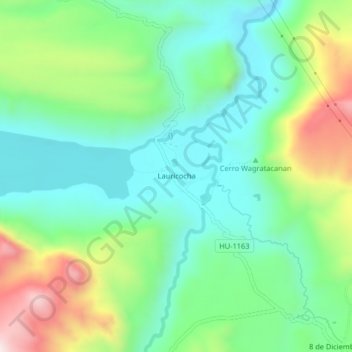
Name: Lauricocha topographic map, elevation, terrain.

Location: Lauricocha, San Miguel de Cauri, Lauricocha, Huánuco, Perú (-10.33550 -76.67859 -10.29550 -76.63859)

Average elevation: 13,130 ft

Minimum elevation: 12,530 ft

Maximum elevation: 14,442 ft

Gear up for your next adventure:

🚪Portable Camp Chair - Foldable chair for comfort at camp
🧭Orienteering Set - Complete compass and map reading kit
📖Nature Tracking Books - Learn to track wildlife and terrain
🌐World Map Poster - Decorative world maps with topographic info
🧤Hiking Gloves - Protective gloves for rugged trails

As an Amazon Associate, this site earns from qualifying purchases at no extra cost to you.