
El Mahboubine topographic map
Interactive map
Click on the map to display elevation.
About this map
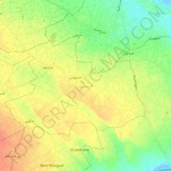
Name: El Mahboubine topographic map, elevation, terrain.
Location: El Mahboubine, Djerba Midoun, Médenine, 4165, Tunisie (33.77140 10.91155 33.81495 11.00005)
Average elevation: 69 ft
Minimum elevation: -10 ft
Maximum elevation: 125 ft
Other topographic maps
Click on a map to view its topography, its elevation and its terrain.
Parc National Sidi Toui
Parc National Sidi Toui, El Amria, Ben Guerdane, Médenine, Tunisie
Average elevation: 341 ft