
Make a donation
Gear up for your next adventure:
As an Amazon Associate, this site earns from qualifying purchases at no extra cost to you.
Sheffield topographic map
Click on the map to display elevation.
Make a donation
Gear up for your next adventure:
As an Amazon Associate, this site earns from qualifying purchases at no extra cost to you.
About this map
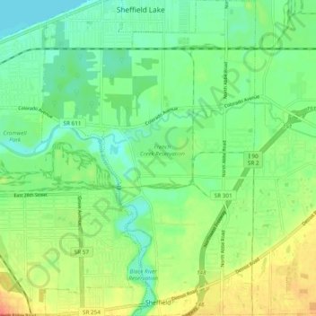
Name: Sheffield topographic map, elevation, terrain.
Location: Sheffield, Lorain County, Ohio, 44054, United States (41.41804 -82.13156 41.48964 -82.06684)
Average elevation: 627 ft
Minimum elevation: 561 ft
Maximum elevation: 738 ft
Lorain County trails, hiking, mountain biking, running and outdoor activities
Make a donation
Gear up for your next adventure:
As an Amazon Associate, this site earns from qualifying purchases at no extra cost to you.
Other topographic maps
Click on a map to view its topography, its elevation and its terrain.
Pine Ridge Trailer Park
United States > Ohio > Lorain County > North Ridgeville
Average elevation: 748 ft
Make a donation
Gear up for your next adventure:
As an Amazon Associate, this site earns from qualifying purchases at no extra cost to you.