
Thank you for supporting this site ❤️
Make a donation
Make a donation
Gear up for your next adventure:
As an Amazon Associate, this site earns from qualifying purchases at no extra cost to you.
Yoloctzin topographic map
Click on the map to display elevation.
Thank you for supporting this site ❤️
Make a donation
Make a donation
Gear up for your next adventure:
As an Amazon Associate, this site earns from qualifying purchases at no extra cost to you.
About this map
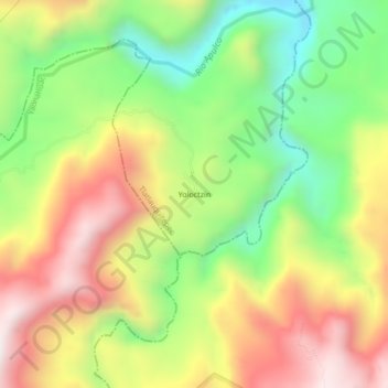
Name: Yoloctzin topographic map, elevation, terrain.
Location: Yoloctzin, Tlatlauquitepec, Puebla, Mexico (19.93500 -97.42389 19.97500 -97.38389)
Average elevation: 2,470 ft
Minimum elevation: 1,050 ft
Maximum elevation: 4,039 ft
Thank you for supporting this site ❤️
Make a donation
Make a donation
Gear up for your next adventure:
As an Amazon Associate, this site earns from qualifying purchases at no extra cost to you.