Geolocate

Kingston topographic map

Click on the map to display elevation.

About this map

Name: Kingston topographic map, elevation, terrain.

Location: Kingston, Norfolk Island, Burnt Pine, Norfolk Island, 2899, Australia (-29.07636 167.93957 -29.03636 167.97957)

Average elevation: 161 ft

Minimum elevation: 0 ft

Maximum elevation: 502 ft

Other topographic maps

Click on a map to view its topography, its elevation and its terrain.
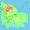
Norfolk Island

Australia > Burnt Pine

Average elevation: 190 ft

Gear up for your next adventure:

🧯Emergency Survival Kit - All‑in‑one survival essentials for the backcountry
🏕️Tent Footprint - Protect your tent base from wear
🔪Outdoor Multitools - Essential survival tools for gear repair and field use
🎒Outdoor Daypacks - Lightweight backpacks designed for carrying maps and essential gear
🎒Gear Packing Cubes - Organize your backpack efficiently

As an Amazon Associate, this site earns from qualifying purchases at no extra cost to you.