
Make a donation
Gear up for your next adventure:
As an Amazon Associate, this site earns from qualifying purchases at no extra cost to you.
Capitol Hill topographic map
Click on the map to display elevation.
Make a donation
Gear up for your next adventure:
As an Amazon Associate, this site earns from qualifying purchases at no extra cost to you.
About this map
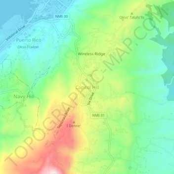
Name: Capitol Hill topographic map, elevation, terrain.
Average elevation: 492 ft
Minimum elevation: 0 ft
Maximum elevation: 1,404 ft
Make a donation
Gear up for your next adventure:
As an Amazon Associate, this site earns from qualifying purchases at no extra cost to you.
Other topographic maps
Click on a map to view its topography, its elevation and its terrain.
Saipan
United States > Northern Mariana Islands > Saipan Municipality > Garapan
Saipan, the largest island in the Northern Mariana Islands, features a diverse and rugged topography shaped by volcanic activity. The island's central region is dominated by Mount Tapochau, its highest peak at 1,553 feet (474 meters), providing a dramatic backdrop to the surrounding landscape. This volcanic…
Average elevation: 72 ft
Saipan
United States > Northern Mariana Islands > Saipan Municipality > Garapan
The highest elevation on Saipan is a limestone-covered mountain called Mount Tapochau at 1,560 ft (480 m). Unlike many of the mountains in the Mariana Islands, it is not an extinct volcano but is a limestone formation.
Average elevation: 72 ft
Bird Island Marine Protected Area
United States > Northern Mariana Islands > Saipan Municipality
Average elevation: 151 ft
Make a donation
Gear up for your next adventure:
As an Amazon Associate, this site earns from qualifying purchases at no extra cost to you.