Geolocate

Mentor topographic map

Click on the map to display elevation.

About this map
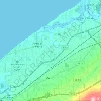
Name: Mentor topographic map, elevation, terrain.

Location: Mentor, Lake County, Ohio, 44060, United States (41.64021 -81.39095 41.75889 -81.29073)

Average elevation: 650 ft

Minimum elevation: 564 ft

Maximum elevation: 1,263 ft

Lake County trails, hiking, mountain biking, running and outdoor activities

Other topographic maps

Click on a map to view its topography, its elevation and its terrain.

Lane

United States > Ohio > Lake County

Average elevation: 692 ft

Mentor-on-the-Lake

United States > Ohio > Lake County > Mentor

Average elevation: 610 ft

Madison-on-the-Lake

United States > Ohio > Lake County

Average elevation: 591 ft

Gear up for your next adventure:

🖼️Topo Map Wall Art - Decorative topographic prints of famous peaks and regions
🌲Outdoor Survival Books - Best books on survival skills
🚑Emergency Bivvies - Heat-reflective sleeping bags for survival situations
🏔️Mountain Trail Maps - High‑detail maps for popular peaks
💧Water Purification System - Clean water on the trail with reliable purifiers

As an Amazon Associate, this site earns from qualifying purchases at no extra cost to you.