
Thank you for supporting this site ❤️
Make a donation
Make a donation
Gear up for your next adventure:
As an Amazon Associate, this site earns from qualifying purchases at no extra cost to you.
Baga topographic map
Click on the map to display elevation.
Thank you for supporting this site ❤️
Make a donation
Make a donation
Gear up for your next adventure:
As an Amazon Associate, this site earns from qualifying purchases at no extra cost to you.
About this map
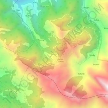
Name: Baga topographic map, elevation, terrain.
Location: Baga, Darlaghat, Solan, Himachal Pradesh, India (31.31049 76.87119 31.35049 76.91119)
Average elevation: 3,839 ft
Minimum elevation: 1,732 ft
Maximum elevation: 6,063 ft
Thank you for supporting this site ❤️
Make a donation
Make a donation
Gear up for your next adventure:
As an Amazon Associate, this site earns from qualifying purchases at no extra cost to you.