
Cotelo topographic map
Interactive map
Click on the map to display elevation.
About this map
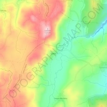
Name: Cotelo topographic map, elevation, terrain.
Location: Cotelo, Gosende, Castro Daire, Viseu, Portugal (40.99349 -7.95093 41.03349 -7.91093)
Average elevation: 3,474 ft
Minimum elevation: 3,009 ft
Maximum elevation: 3,970 ft
Other topographic maps
Click on a map to view its topography, its elevation and its terrain.
Peixeninho
Portugal > Viseu > Castro Daire > Gosende
Peixeninho, Gosende, Castro Daire, Viseu, Portugal
Average elevation: 3,179 ft
Rossão
Portugal > Viseu > Castro Daire > Gosende
Rossão, Gosende, Castro Daire, Viseu, Portugal
Average elevation: 3,596 ft