Geolocate

Lusby topographic map

Click on the map to display elevation.

About this map

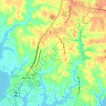
Name: Lusby topographic map, elevation, terrain.

Location: Lusby, Calvert County, Maryland, United States (38.33372 -76.45958 38.38872 -76.40869)

Average elevation: 62 ft

Minimum elevation: -7 ft

Maximum elevation: 141 ft

Calvert County trails, hiking, mountain biking, running and outdoor activities

Gear up for your next adventure:

👟Trail Running Shoes - Lightweight shoes for trail runners
🎒Trail Energy Bars - High‑calorie bars for hiking energy
📖Nature Tracking Books - Learn to track wildlife and terrain
🧤Tactile Hiking Gloves - Keep hands warm while operating GPS and smartphone screens
🥄Camping Utensil Set - Lightweight utensils for outdoor meals

As an Amazon Associate, this site earns from qualifying purchases at no extra cost to you.