
Thank you for supporting this site ❤️
Make a donation
Make a donation
Gear up for your next adventure:
As an Amazon Associate, this site earns from qualifying purchases at no extra cost to you.
Jakar topographic map
Click on the map to display elevation.
Thank you for supporting this site ❤️
Make a donation
Make a donation
Gear up for your next adventure:
As an Amazon Associate, this site earns from qualifying purchases at no extra cost to you.
About this map
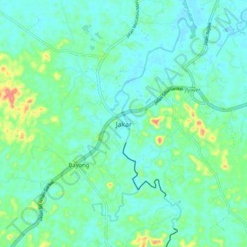
Name: Jakar topographic map, elevation, terrain.
Location: Jakar, Sarikei, Sarikei Division, Sarawak, Malaysia (2.00390 111.45419 2.08390 111.53419)
Average elevation: 59 ft
Minimum elevation: -7 ft
Maximum elevation: 262 ft
Thank you for supporting this site ❤️
Make a donation
Make a donation
Gear up for your next adventure:
As an Amazon Associate, this site earns from qualifying purchases at no extra cost to you.