
Thank you for supporting this site ❤️
Make a donation
Make a donation
Gear up for your next adventure:
As an Amazon Associate, this site earns from qualifying purchases at no extra cost to you.
Ndori topographic map
Click on the map to display elevation.
Thank you for supporting this site ❤️
Make a donation
Make a donation
Gear up for your next adventure:
As an Amazon Associate, this site earns from qualifying purchases at no extra cost to you.
About this map
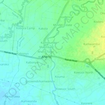
Name: Ndori topographic map, elevation, terrain.
Location: Ndori, Ahero ward, Nyando, Kisumu County, Nyanza, Kenya (-0.19074 34.90148 -0.15074 34.94148)
Average elevation: 3,786 ft
Minimum elevation: 3,763 ft
Maximum elevation: 3,822 ft
Thank you for supporting this site ❤️
Make a donation
Make a donation
Gear up for your next adventure:
As an Amazon Associate, this site earns from qualifying purchases at no extra cost to you.