
Thank you for supporting this site ❤️
Make a donation
Make a donation
Gear up for your next adventure:
As an Amazon Associate, this site earns from qualifying purchases at no extra cost to you.
Wotu topographic map
Click on the map to display elevation.
Thank you for supporting this site ❤️
Make a donation
Make a donation
Gear up for your next adventure:
As an Amazon Associate, this site earns from qualifying purchases at no extra cost to you.
About this map
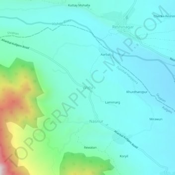
Name: Wotu topographic map, elevation, terrain.
Location: Wotu, Damhal Hanjipora, Kulgam, Jammu and Kashmir, India (33.62063 74.81077 33.66063 74.85077)
Average elevation: 7,221 ft
Minimum elevation: 6,690 ft
Maximum elevation: 9,514 ft
Thank you for supporting this site ❤️
Make a donation
Make a donation
Gear up for your next adventure:
As an Amazon Associate, this site earns from qualifying purchases at no extra cost to you.