Geolocate

Perleto topographic map

Click on the map to display elevation.

About this map

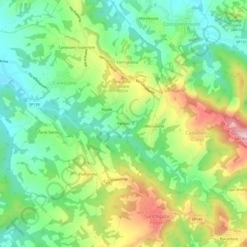
Name: Perleto topographic map, elevation, terrain.

Location: Perleto, Carezzano, Alessandria, Piedmont, Italy (44.78026 8.89362 44.82026 8.93362)

Average elevation: 1,010 ft

Minimum elevation: 643 ft

Maximum elevation: 1,621 ft

Gear up for your next adventure:

🪶Camp Gear Gift Set - Perfect gift bundle for outdoor fans
🛡️Insect Repellent - Protection against bugs during outdoor activities
🧦Hiking Socks - Comfortable socks to prevent blisters on long hikes
🔥Plasma Lighters - Windproof lighters that work in any weather condition
🧣Merino Neck Gaiters - Multi-functional headwear for wind and sun protection

As an Amazon Associate, this site earns from qualifying purchases at no extra cost to you.