Geolocate

Sundaram Shozhapuram topographic map

Click on the map to display elevation.

About this map
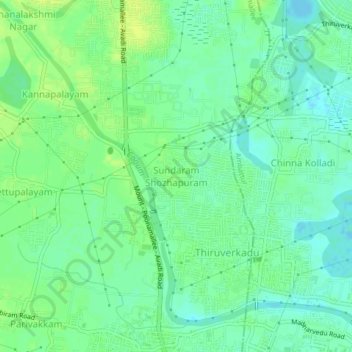
Name: Sundaram Shozhapuram topographic map, elevation, terrain.

Location: Sundaram Shozhapuram, Poonamallee, Thiruvallur, Tamil Nadu, 600077, India (13.06143 80.09452 13.10143 80.13452)

Average elevation: 66 ft

Minimum elevation: 39 ft

Maximum elevation: 89 ft

Other topographic maps

Click on a map to view its topography, its elevation and its terrain.

Cooum

India > Tamil Nadu > Poonamallee

Average elevation: 89 ft

Gear up for your next adventure:

👖Convertible Hiking Pants - Versatile zip-off pants for changing altitudes and temperatures
🚪Portable Camp Chair - Foldable chair for comfort at camp
🩹Survival Bandages - High‑quality bandages for emergencies
🗺️NatGeo Topo Maps - High-quality waterproof printed topographic maps of US Parks
🔭Stargazing Telescopes - Perfect for camping in low-light pollution areas shown on maps

As an Amazon Associate, this site earns from qualifying purchases at no extra cost to you.