
Fonte de Sesimbra topographic map
Interactive map
Click on the map to display elevation.
About this map
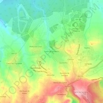
Name: Fonte de Sesimbra topographic map, elevation, terrain.
Average elevation: 407 ft
Minimum elevation: 164 ft
Maximum elevation: 745 ft
Other topographic maps
Click on a map to view its topography, its elevation and its terrain.
Castelo de Sesimbra
Portugal > Setúbal > Sesimbra > Sesimbra (Castelo) > Corredoura
Average elevation: 436 ft