
Thank you for supporting this site ❤️
Make a donation
Make a donation
Gear up for your next adventure:
As an Amazon Associate, this site earns from qualifying purchases at no extra cost to you.
Pono topographic map
Click on the map to display elevation.
Thank you for supporting this site ❤️
Make a donation
Make a donation
Gear up for your next adventure:
As an Amazon Associate, this site earns from qualifying purchases at no extra cost to you.
About this map
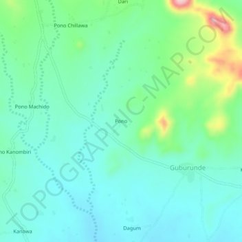
Name: Pono topographic map, elevation, terrain.
Location: Pono, Guburunde, Wuyo, Bayo, Borno State, Nigeria (10.32328 11.74259 10.36328 11.78259)
Average elevation: 1,050 ft
Minimum elevation: 902 ft
Maximum elevation: 1,522 ft
Thank you for supporting this site ❤️
Make a donation
Make a donation
Gear up for your next adventure:
As an Amazon Associate, this site earns from qualifying purchases at no extra cost to you.