
Thank you for supporting this site ❤️
Make a donation
Make a donation
Gear up for your next adventure:
As an Amazon Associate, this site earns from qualifying purchases at no extra cost to you.
Schurz topographic map
Click on the map to display elevation.
Thank you for supporting this site ❤️
Make a donation
Make a donation
Gear up for your next adventure:
As an Amazon Associate, this site earns from qualifying purchases at no extra cost to you.
About this map
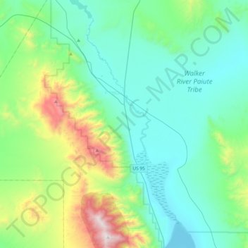
Name: Schurz topographic map, elevation, terrain.
Location: Schurz, Mineral County, Nevada, 89427, United States (38.77130 -118.91184 39.06341 -118.67316)
Average elevation: 5,023 ft
Minimum elevation: 3,947 ft
Maximum elevation: 9,170 ft
Mineral County trails, hiking, mountain biking, running and outdoor activities
Thank you for supporting this site ❤️
Make a donation
Make a donation
Gear up for your next adventure:
As an Amazon Associate, this site earns from qualifying purchases at no extra cost to you.